

Goldilocks Storm Brings Record Snowfall
A powerful nor’easter hammered the U.S. Northeast with historic snowfall totals, creating what meteorologists described as a rare “Goldilocks” weather setup that produced near-perfect conditions for a record-setting blizzard.
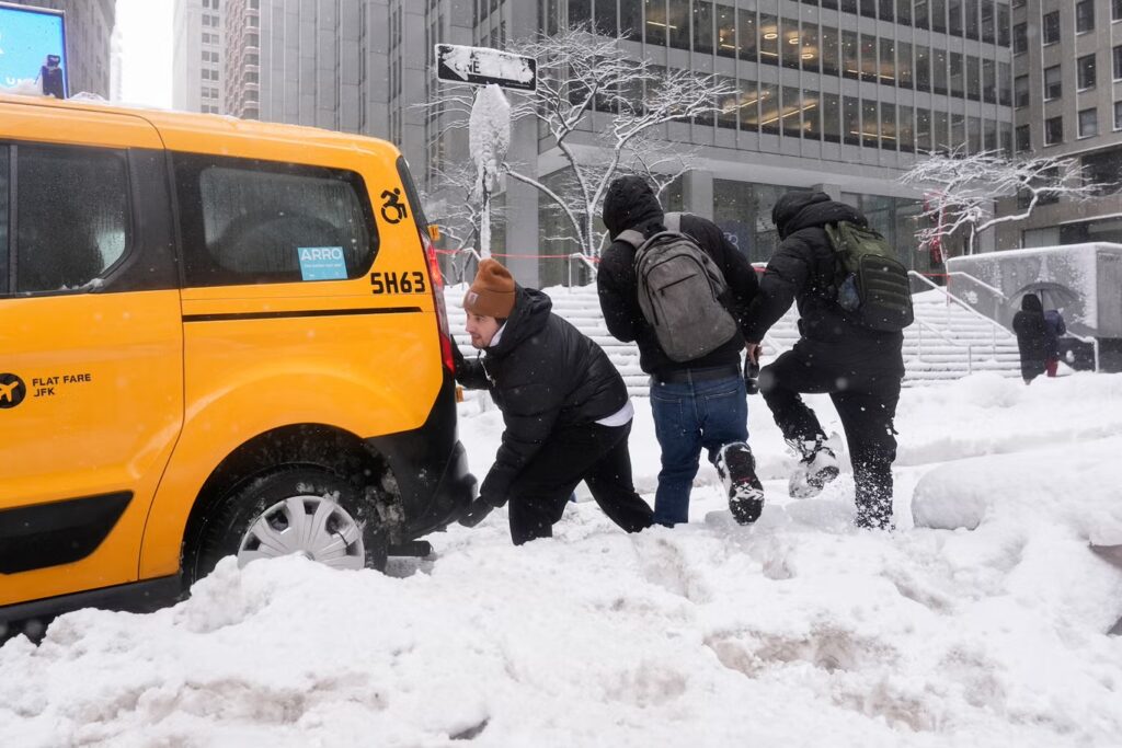
The massive winter storm dumped nearly three feet of snow in some areas, paralyzed major cities along the Eastern Seaboard, and rapidly intensified into what experts classified as a “bomb cyclone.” Weather specialists say it is one of the most intense winter storms to strike the region in more than a decade.
Classic Nor’easter Intensifies into Bomb Cyclone
The storm strengthened dramatically over a 24-hour period, with its central atmospheric pressure plunging 39 millibars — far exceeding the 24-millibar threshold required for “bombogenesis.” At its peak, the storm’s pressure dropped to 966 millibars, a level comparable to a Category 2 hurricane if it had been a tropical system.
Meteorologists described it as “a hurricane with snow,” fueled by the sharp temperature contrast between frigid air over land and warm, moisture-rich air over the Atlantic Ocean. That clash of air masses provided the energy needed for explosive intensification.
The ‘Goldilocks’ Snow Sweet Spot
Experts say the storm hit the perfect temperature balance — not too warm and not too cold — creating ideal conditions for heavy, wet snowfall.
If temperatures had been slightly warmer, precipitation would have fallen as rain. If colder, the atmosphere would have held less moisture, reducing total snowfall. Instead, the region experienced what meteorologists call a snowfall “sweet spot,” maximizing accumulation totals.
The storm also followed an ideal track. Had it moved farther inland, it would have lost access to warm ocean energy. If it had shifted further offshore, the heaviest snow would have remained over open water.
Record Snowfall Totals Across the Northeast
Several cities reported historic snowfall amounts:
- Providence recorded 32.8 inches, breaking its all-time snowfall record set in 1978.
- Islip Airport in Long Island measured 26.5 inches.
- Freehold, New Jersey, saw 24.2 inches.
- Southampton, New York, recorded 24 inches.
- New York City surpassed 15 inches.
- Philadelphia exceeded 13 inches.
Snow was still falling in many locations as totals continued to rise.
Wet, Heavy Snow Raises Health Concerns
Meteorologists warned residents about the dangers of shoveling heavy, moisture-packed snow, which significantly increases the risk of heart attacks and overexertion.
Officials advised taking frequent breaks while clearing snow and avoiding strenuous activity.
Thundersnow and Lightning Add to the Spectacle
Adding to the storm’s intensity, rare thundersnow and lightning were reported — phenomena typically seen only in the most powerful winter systems. Lightning was observed striking near coastal Massachusetts and even a skyscraper in New York City.
Thundersnow occurs when strong atmospheric instability combines with heavy snowfall rates, creating conditions similar to summer thunderstorms.
Climate Connection: Are Strong Nor’easters Increasing?
Recent studies suggest that while climate change may reduce the total number of winter storms, the strongest nor’easters are becoming more intense. Scientists point to a warming Arctic and a stretching polar vortex as contributing factors that can push ultra-cold air further south.
Meteorologists described the storm’s satellite imagery as textbook — nearly picture-perfect in its structure and symmetry — making it a classic example of how extreme winter weather systems form.A powerful nor’easter hammered the U.S. Northeast with historic snowfall totals, creating what meteorologists described as a rare “Goldilocks” weather setup that produced near-perfect conditions for a record-setting blizzard.
The massive winter storm dumped nearly three feet of snow in some areas, paralyzed major cities along the Eastern Seaboard, and rapidly intensified into what experts classified as a “bomb cyclone.” Weather specialists say it is one of the most intense winter storms to strike the region in more than a decade.
Classic Nor’easter Intensifies into Bomb Cyclone
The storm strengthened dramatically over a 24-hour period, with its central atmospheric pressure plunging 39 millibars — far exceeding the 24-millibar threshold required for “bombogenesis.” At its peak, the storm’s pressure dropped to 966 millibars, a level comparable to a Category 2 hurricane if it had been a tropical system.
Meteorologists described it as “a hurricane with snow,” fueled by the sharp temperature contrast between frigid air over land and warm, moisture-rich air over the Atlantic Ocean. That clash of air masses provided the energy needed for explosive intensification.
The ‘Goldilocks’ Snow Sweet Spot
Experts say the storm hit the perfect temperature balance — not too warm and not too cold — creating ideal conditions for heavy, wet snowfall.
If temperatures had been slightly warmer, precipitation would have fallen as rain. If colder, the atmosphere would have held less moisture, reducing total snowfall. Instead, the region experienced what meteorologists call a snowfall “sweet spot,” maximizing accumulation totals.
The storm also followed an ideal track. Had it moved farther inland, it would have lost access to warm ocean energy. If it had shifted further offshore, the heaviest snow would have remained over open water.
Record Snowfall Totals Across the Northeast
Several cities reported historic snowfall amounts:
- Providence recorded 32.8 inches, breaking its all-time snowfall record set in 1978.
- Islip Airport in Long Island measured 26.5 inches.
- Freehold, New Jersey, saw 24.2 inches.
- Southampton, New York, recorded 24 inches.
- New York City surpassed 15 inches.
- Philadelphia exceeded 13 inches.
Snow was still falling in many locations as totals continued to rise.
Wet, Heavy Snow Raises Health Concerns
Meteorologists warned residents about the dangers of shoveling heavy, moisture-packed snow, which significantly increases the risk of heart attacks and overexertion.
Officials advised taking frequent breaks while clearing snow and avoiding strenuous activity.
Thundersnow and Lightning Add to the Spectacle
Adding to the storm’s intensity, rare thundersnow and lightning were reported — phenomena typically seen only in the most powerful winter systems. Lightning was observed striking near coastal Massachusetts and even a skyscraper in New York City.
Thundersnow occurs when strong atmospheric instability combines with heavy snowfall rates, creating conditions similar to summer thunderstorms.
Climate Connection: Are Strong Nor’easters Increasing?
Recent studies suggest that while climate change may reduce the total number of winter storms, the strongest nor’easters are becoming more intense. Scientists point to a warming Arctic and a stretching polar vortex as contributing factors that can push ultra-cold air further south.
Meteorologists described the storm’s satellite imagery as textbook — nearly picture-perfect in its structure and symmetry — making it a classic example of how extreme winter weather systems form.

